
GIS & Digital Twin
I work at the intersection of geospatial data and real-time 3D, building interactive maps, digital twins and visualizations that make complex spatial information understandable.
TerraFrame
Live & free to try, right in your browser
TerraFrame turns real-world geodata, satellite imagery, terrain heightmaps and OpenStreetMap, into little dioramas: small, stylised 3D models of a chosen patch of the world that anyone can share, edit and explore right in the browser.
From real-world data to a diorama
Pick a location and TerraFrame pulls together open geodata for that patch: satellite imagery for the surface, terrain heightmaps for the elevation, and OpenStreetMap data for the features on the ground.
Those layers are fused and rendered into a compact, stylised 3D model, a diorama that captures a real place as a small, tangible object you can hold in view and turn around.
Edit, share and explore
Every diorama is editable in the browser: add objects, labels and paths to tell a story about the place, then save your TerraFrame.
Sharing is built in. Send a link, or drop an embed like the one above into any page so others can orbit, zoom and explore the diorama for themselves, no install, no plugin.
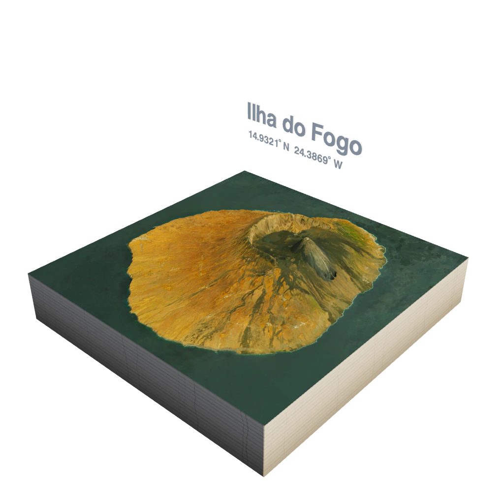
A few dioramas generated with TerraFrame, from a volcanic island to an alpine castle. Each one is built from the real terrain and imagery of that exact spot.
No sign-up, no install. Open the live app and build your first diorama in the browser.
Collision Zero
An accident-simulation VR application that rebuilds real, police-documented accidents, letting you relive them from every participant's point of view.
- XR
- Pico
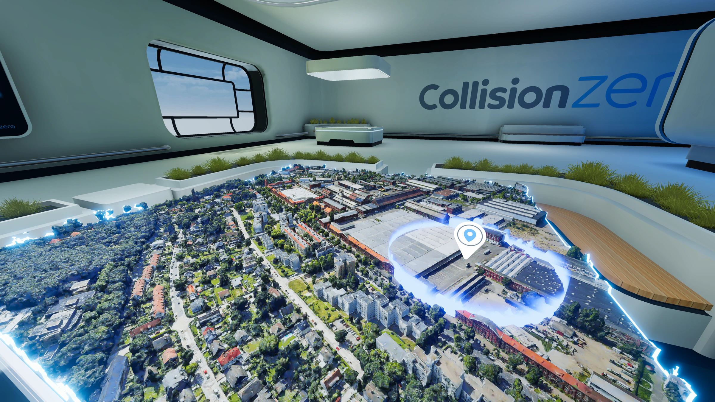
How it works
In cooperation with the Fraunhofer Institute, real accident records are anonymized and turned into precise trajectories for every participant. Those trajectories are fused with data from many sources, including OpenStreetMap, the tree cadastre (Baumkataster), weather, time of day and rainfall, to faithfully reconstruct the entire environment in which the accident happened.
You step into the scene and switch between each participant's perspective to see precisely how the accident unfolded. It supports both industry and public-sector cases.
Built for the headset
The entire environment is generated on the VR device at runtime, in just a few seconds, heavily optimized for mobile VR hardware. Making that possible required a range of custom algorithms and deep performance optimization.
The application is designed for non-technical users and children aged five and up, which made UX and UI design a central and demanding part of the project.
- My role
- Lead Developer, responsible for the full application: architecture, project management, concept & exploration, and UI/UX design.
- Partners
- Built at Wildstyle Network in cooperation with Fraunhofer IVI.
- Funded by

Got data and no idea what to do with it?
If you have data, spatial or otherwise, and want to see it brought to life inside a 3D model of its real-world environment, that is exactly the kind of work I do. Tell me what you're sitting on and we'll figure out how to show it.
Get in touch